Table of Contents
Severe Thunderstorm Warning
We all know that natural phenomena are unavoidable. Sometimes it does not cause a lot of damage but sometimes it can be destructive to infrastructures, livestock, and mankind. Some examples of natural phenomena are earthquakes, hurricanes, and thunderstorms.
These natural phenomena may not be or may be destructive depending on their intensity. This article will be discussing severe thunderstorm warnings, the recent thunderstorms that occurred, and some tips to keep oneself safe from thunderstorms, before, during, and after their occurrence.

What is a Thunderstorm?
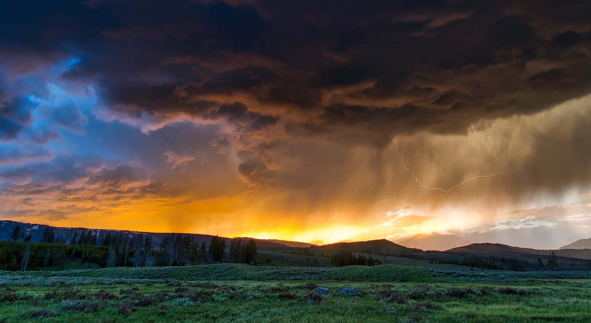
A thunderstorm is a type of weather disturbance that only happens for a short time. This type of weather disturbance is usually associated with thunder, dense and dark clouds, lightning, heavy downpour of rain, and strong winds, strong enough to knock out some trees, fences, and worse, it can also knock out infrastructures. Thunderstorms happen when layers of warm air pile up and moved to cooler regions.
The moisture that was piled up were then formed into tall cumulonimbus clouds and will then start to precipitate or in simple terms, it will start to rain. The cool air that was accumulated will then start to sink down to land, striking land with strong downpours with intense horizontal winds and at the same time, charges of electricity will start to accumulate on the clouds. This is when lightning occurs, when the electrical charges that were accumulated becomes a significantly large number enough to cause a lightning strike.
This lightning will then start to warm up the air as it passes quickly then shock waves are then produced, these said shock waves produce a deafening sound which is called thunder or thunderclap. On some occasions, thunderstorms with a higher severity are accompanied by swirls of air which start to become concentrated, increasing its intensity and speed thus forming tornadoes or hurricanes.
Thunderstorms are notoriously known to occur in almost every region globally although polar regions rarely experience thunderstorms, as well as regions with latitudes that are higher than 50 degrees North and 50 degrees South. On the other hand, the tropical regions of the world are more prone to thunderstorms due to the humidity and moisture these regions have in their air.
Which Areas of the World Experience a Huge Amount of Thunderstorm Days?
One of the known countries to experience a large amount of thunderstorms is the United States of America. Most likely in the state of Florida which experiences more than 80 thunderstorm days every single year with some areas having to experience 100 thunderstorm days per year.
Next is the Gulf Coast which experiences an average range of 60 up to 90 thunderstorm days every year, followed by the higher regions of New Mexico, its mountains experience about an average thunderstorm days of 50 up to 80. While the honourable mentions, Central Europe and Asia has an average of 20 up to 60 thunderstorm days every single year. It was also calculated that in every moment passing by, there had been an approximate amount of over 1,800 thunderstorms that are currently happening all throughout the world.
What are the Strongest Thunderstorms that have been Recorded?
The Derecho in Iowa
Back in central Iowa, during the month of August, a thunderstorm occurred. It was said that the thunderstorm was one of the most destructive and most costly thunderstorms recorded in the history of the United States of America.
According to the National Oceanic and Atmospheric Administration, it was said that the thunderstorm travelled about 770 miles from South Dakota, going through Ohio in just a span of 14 hours, and has already cost damages worth $7.5 billion and still counting. Multiple land fields of corn and soybean crops were damaged, as well as homes, businesses, vehicles, due to the thunderstorm. Cedar Rapids in Iowa, was particularly severely damaged. Thousands of citizens filed for unemployment insurance, while other residents were still unable to return or go back to their homes for two months after the thunderstorm’s landfall.

This is indirectly a thunderstorm and it is referred to as a derecho. A derecho is a type of phenomena with a neck-breaking speed of a windstorm and associated with extreme thunderstorms. The derecho struck Iowa back in the month of August and has brought and sustained winds with a speed of 100 miles per hour, which easily eased its way to the top five most expensive natural phenomena that the United States of America has experienced. This derecho has brought about a damage that has even surpassed most tornadoes and hurricanes that the country has experienced in history. Only hurricane Laura has caused costly damage worth $14 billion.
The thunderstorm began forming in Eastern Nebraska as well as in the southern part of South Dakota from early morning back on August 10. The thunderstorm uprooted trees, caused them to stumble, damaged structures, as well as cut off the power supply of over half a million people in the United States of America. According to the National Oceanic and Atmospheric Administration, about an estimated percentage of 90% of the structures built in the Cedar Rapids were heavily destroyed by the storm, and more than a thousand of the homes were also destroyed. Not only did it impact Cedar Rapids, but the thunderstorm also impacted states like Illinois, Ohio, Minnesota, and India. Sadly, four people were killed by the thunderstorm with three of them being Iowans.
Within a few weeks of the thunderstorm, thousands of Iowa residents, most of them workers, were heavily impacted by the derecho. These residents filed for unemployment benefits and the governor of Kim Reynolds requested about $4 billion in federal aid in order to help the state’s industry in agriculture since it was heavily damaged by the derecho.
The United States of America estimated that the total crop acres that were lost amounted to 850,000 which was 50% more than what was initially estimated. Added to this was the fact that the derecho had a landfall during August even caused more detriment to the state as Allan Curtis, a meteorologist who works under the National Weather Service of Des Moines stated the Des Moines Register. This was because the crops that were lost had been growing for months during August and they were already huge enough to get caught in the wind. Allan Curtis also mentioned that if only the plants would have been small at the time when the thunderstorm occurred, they would have been somehow saved since they were closer to the ground, and they were much more intact due to their roots’ hold on the ground.
Even now, Iowans who experienced the grave damage of the derecho were still heavily affected by it since it was extremely traumatizing. Local businesses were said to have been collecting some furniture and funds to donate to the victims located in Cedar Rapids, in which some of them have not been returned to their homes yet and some were homeless due to the destruction of their homes. The Lutheran Church of Hope who works with other local companies also filled four semi-trucks full of furniture donations for the victims.
Megaflash in the United States of America
The World Meteorological Organisation announced back on Monday that the organization had confirmed two new lightning mega flashes. The record was said to occur over the lower 48 states of the United States of America.
Back in the year 2020, on the 29th of April, there was a recorded mass of thunderstorms which produced a lightning strike with a length of 477.2 miles over the lower states of the United States of America. The lightning strike stretched from Houston up to the southeast of Mississippi, which was a distance that equates between the distances of Columbus, Ohio, and New York City. This said megaflash record also beat the world record of the megaflash which occurred in southern Brazil with a length of 440 miles which occurred back in the Halloween of the year 2018.
The World Meteorological Organisation also identified yet again another world record for the megaflash. This record was from the skies of Uruguay and Northern Argentina which was recorded to be one of the most long-lasting mega flashes in history. The recorded mega flash was said to have lasted for about 17.1 seconds in the year 2020 back on the 18th of June. This new record surpassed the mega flashback in northern Argentina which lasted about 16.73 seconds back in the year 2019, on the 4th of March. As Randall Cerveny even said, a reporter from the Weather and Climate Extremes for the World Meteorological Organisation, the long-lasting mega flash are extraordinary records from single lightning flash occurrences.
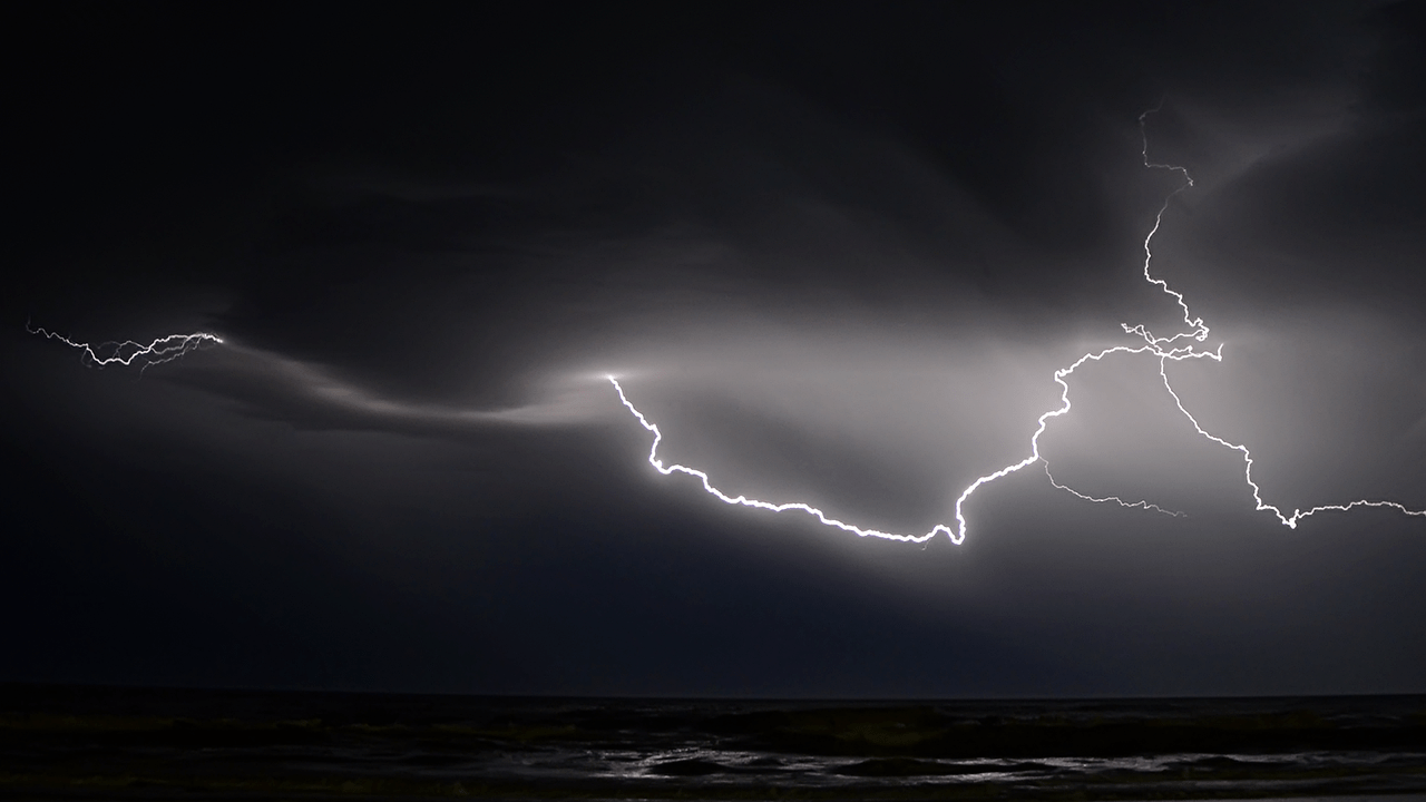
But what are mega flashes anyways? Mega flashes grander than the normal lightning strikes that we see in a thunderstorm. We have become so accustomed to seeing the occurrences in the near ground which includes the usual cloud-to-ground lightning bolts. Hundreds of thousands of strikes might also be associated with a thunderstorm in the afternoon.
Mega flashes on the other hand are different because mega flashes from the name itself are enormous or huge lightning strikes. This kind of lightning strikes snake through regions with a huge amount of electricity and it can also travel long lengths which can range from hundreds of miles and it also lasts for a long time with more than 10 seconds long. Most storm clouds are only about 10 miles high with a vertical orientation which is why they tend to be shorter. As for mega flashes, they strike horizontally which is why they have longer lengths, unlike the usual lightning strikes we see on occasion.
We should also take note that all mega flashes are accompanied by MCSs or mesoscale convective systems. Mesoscale convective systems are groups of thunderstorms that often occur overnight and can also occupy an area with the size of multiple states. Mesoscale convective systems last for hours and can stretch up to 750 miles or even more end-to-end. Mesoscale convective systems are usually a staple during the spring season as well as the early times of summer in the southern and central states of the United States of America. Mesoscale convective systems are also common in Brazil, Argentina, and Uruguay. Lastly, South America’s “Altiplano” or the high Andean Plateau also experiences these extreme thunderstorms associated with long lightning strikes.
Mega Flashes stalk through the clouds, yet at various locations, they can produce or induce ground connections. When MCSs merge, the resulting electric fields become magnified and more chaotic, which can potentially allow mega flashes. Because they cover such a large area, mega flashes flicker for a long time.
How are these mega flashes detected in the first place? Well, although atmospheric electrodynamics have long postulated that mega flashes exist, the size and duration of such flashes have not been fully understood. The best methods for mapping cloud-to-ground discharges are conventional lightning detection arrays, which rely on a system of ground-based sensors to detect an electromagnetic field from a strike and utilize multi-station triangulation to pinpoint its location.
The remarkable rarity and size of these extreme lightning episodes make it very challenging to detect them, according to Michael J. Peterson of the Los Alamos National Laboratory’s Space and Remote Sensing Group in an email. “To be able to see it, your sensor must be at precisely the correct location at precisely the right time, and the instrument must be able to measure something as massive as a mega flash. In the past, most sensors haven’t met these standards.
That changed with the launch of the GOES East and GOES West weather satellites on November 19, 2016, and shortly after. Both observe North America from 22,236 miles above the surface of the planet and are equipped with “Geostationary Lighting Mappers,” or devices that can identify the infrared signal brought on by a lightning flash. This makes it possible to track intracloud and cloud-to-cloud flashes from above.
Similar satellite-mounted tools were available before GOES East and West, but they could only monitor smaller areas for a shorter period of time. In fact, the geostationary lightning mappers on GOES satellites take an image every two milliseconds; in the upcoming years, Europe and China will also be using similar space-borne sensors.
How common are these mega flashes exactly? There is reason to think that mega flashes may occur more frequently than previously thought. Now that they can be seen and resolved over North America, scientists may start compiling a timeline of occurrences.
On the morning of October 23, 2017, there was one very remarkable discharge that eventually covered 300 kilometers but was not assessed by the WMO. Near Thackerville, Oklahoma, a little more than an hour’s drive north of the Dallas-Fort Worth Metroplex, a thunderstorm was raging. At 12:13 in the morning, a bolt of lightning lit up the sky close to the Red River, which forms Oklahoma’s southern border.
The same 300-mile-long lightning strike that lit up the landscape outside Burlington, Kansas, also lighted an area that was four times the size of Connecticut.
Peterson stated in the WMO announcement that “now that we have a strong record of these monster flashes, we can begin to understand how they arise and comprehend the disproportionate impact that they have.” He performed
The organization has also been monitoring previous lightning records and has taken advantage of the most recent news to emphasize how crucial lightning safety is. Any time thunder can be heard, someone is within striking distance of a lightning strike.
According to Ron Holle, a lightning expert, “the only lightning-safe settings are major buildings with electrical and plumbing; not structures such as at a beach or bus stop.” Because they are embedded within larger thunderstorms, lightning strikes can travel great distances in a matter of seconds, as these extreme occurrences demonstrate.
Sources:
https://www.washingtonpost.com/weather/2022/01/31/world-record-lightning-megaflash-us/

